
(Sage Smiley / KSTK)
The island mountains and valleys of Alaska’s panhandle may look unchanging, but the area is moving rapidly in a geologic sense. KSTK sat down with a research geologist from the U.S. Geological Survey to talk about the deepest history of Southeast.
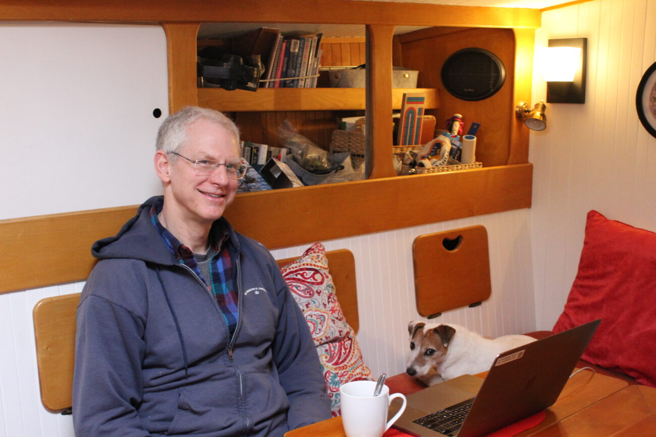
“Come on aboard,” Geologist Peter Haeussler says, responding to three sharp knocks on the deck of his 45-foot aluminum-hulled sailing boat, the Mucho Gusto. It’s home-ported in Wrangell.
His head peeks out of a cabin hatch in the center of the boat. Haeussler’s friendly dog, Happy, is part of the greeting committee, but has to be lifted down the narrow ladder to the main cabin.
(Sage Smiley / KSTK)
Haeussler lives in Anchorage, but he has spent three decades researching the rocks of Southeast. He did his Ph.D. dissertation on a belt of rocks between Wrangell and Juneau that he “got quite interested in.”
“I think the fascinating part of geology is that you end up looking at the landscape in a world through a very different set of eyeglasses than I think a lot of other people do,” Haeussler says.
And that set of eyeglasses is what Haeussler calls “deep time” – events on a scale that dwarfs human lifetimes or even civilizations.
“I think it’s really easy for people to think about time in terms that we know and we experience,” Haeussler explains, “Which is, you know, ‘It’s spring now and you know, getting over winter, you know, it’s going to be warm in the summer.’”
Human timespans pale in comparison to geologic ones, Haeussler says. He says to really understand geology, you’ve got to think not in terms of tens or hundreds of years, but thousands to millions of years.
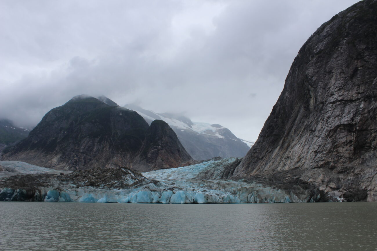
“So when I look at the landscape around here,” Haeussler explains, “I often think of what it was like maybe 20-25,000 years ago, when there was ice filling all of these valleys and over the tops of most of the mountains and just thinking what a different world it was at that point. Or when looking at some of the older rocks in Southeast Alaska, I mean, it seems as if most of Southeast Alaska is a piece that came from somewhere else and trying to think about the process, probably the warm tropical environments that it came from on the order of 400 million years ago. And it was out in the middle of the ocean. Pretty different”
Southeast Alaska, Haeussler says, is geologically unique. The region’s history is less as a part of a huge land mass experiencing slow continental drift, but as a smaller, more mobile chunk of crust – think of island areas like the South Pacific or around Japan.
What is now Southeast Alaska – called the Alexander Terrain by geologists – probably started out near the equator. At least that’s as far back as geologists can have any idea, based on fossils here.
“Then it moved around, and then it had collisions with other little pieces and chunks, and then finally, really got crunched up against the North American margin probably in Cretaceous time,” Haeussler explains. “It would have been during the time of the big meat-eating dinosaurs or maybe a little before. And then was probably at some latitude a bit south of this, we don’t really know exactly how far and then it got sort of slivered northward along the North American margin such that it ended up getting parked here today.”
There’s another especially interesting geological history in the northernmost part of Southeast – a piece of crust born off the coast of Oregon and Washington sliced its way up the margin of Alaska and has been smashing into the Yakutat area for around 30 million years.
“That’s why there’s the big mountains: the St. Elias Mountains in the Fairweather range. And it’s even had larger-scale effects into interior Alaska,” Haeussler says. “We probably wouldn’t have Denali in the Alaska Range if it weren’t for this big piece of crust punching into the southern Alaska margin.”
It’s not the only major, earth-changing factor in the area. Offshore, there’s a fault called the Queen Charlotte – Fairweather Fault. Haeussler says it’s similar to the better-known San Andreas Fault along the West Coast, but it’s more active.
“In some ways, the Queen Charlotte is like the San Andreas but it’s on steroids: it moves a lot faster. It’s exceedingly sharp. It’s produced more big earthquakes in a shorter period of time,” Haeussler says, “So it’s a very impressive fault system.”
The Queen Charlotte – Fairweather Fault is a strike-slip fault, where two tectonic plates are moving past each other in opposite directions. It’s moving at a whopping 5.3 centimeters per year – the length of a small lime. But compared to the San Andreas Fault, moving about two-thirds that distance each year – maybe the length of a grape – it’s quite quick. Haeussler says fast faults tend to produce more – and bigger – earthquakes.
The fault is visible north of Icy Point in Glacier Bay National Park. That’s where the fault runs on land – while the rest of it is underwater.
“If you’re on an Alaska Airlines flight from Juneau to Anchorage, and it’s a clear day, you can see that fault,” Haeussler says, “It’s this giant groove through the landscape because it’s moving.”
The glacial history of Southeast is also unique. With tons and tons of ice sitting on top of what’s now the Inside Passage, the land got forced down, while on the Outer Coast, it buckled upwards.
“Maybe it’s a little bit like, I don’t know, if you had like a fat uncle that sat next to you on the couch when you’re a kid. But the ice sheet was a little bit like the fat uncle that sort of sat down on things,” Haeussler explains, “And then if you were next to him on the couch, then you’re about to be flipped up in the air because, you know, things go up, but the other part of the wait, so then when the uncle gets up off the couch, then you go back down.”
Haeussler says now that the glaciers have retreated significantly back onto the mainland, the earth’s crust is rebounding. Sites that used to be shoreline near Wrangell are now hundreds of feet in the air, while ancient coastlines on the Outer Coast are slowly sinking.
Haeussler says he made his way to geology through rock climbing: “And then at some point, I got interested in: what were these things that I was holding on to? And then that also got into just wanting to understand the landscape around [me].”
Haeussler says geology was what first drew him to Alaska. He first visited for a geology field camp while in undergrad at Michigan State.
“That was my first visit to Alaska,” he relates, “And I thought it’d be just sort of a one-off, like, that was an interesting experience and [I’d] go and do other things. But for so many of us in Alaska, Alaska gets its claws in you, and then it doesn’t let go.”
While at the University of California Santa Cruz for graduate school, he proposed to study again in Southeast.
“In my mind, I had thought that Alaska is more the region between Anchorage and Fairbanks and not Southeast Alaska,” Haeussler says, “But looking at the issues that the scientific things that were worthwhile to study were ones down here in Southeast Alaska.”
While Southeast residents can’t usually sit and watch rocks move, there are consequences for communities living in geologically tumultuous zones. For example, the fast-moving Queen Charlotte – Fairweather Fault poses major potential seismic hazards to people living in Southeast.
“It’s maybe a little less important for a community like Wrangell that some distance away from it, but if you’re at Sitka or Elfin Cove, you’re really close to it,” Haeussler says, “And ground motions from something like that are something that need to be considered when building buildings, that kind of thing.”
But it’s not just the earthquakes that are a potential hazard. Haeussler points to a 1958 earthquake on the Fairweather fault. It’s maybe most famous for causing a rockfall in Lituya Bay which hit the water and created a megatsunami.
“That is still the world’s highest, world-record tsunami runup that went 1,740 feet, splashed up that hillside and out the bay,” Haeussler says.
Landslides, both on land and in the water, can trigger massive tsunamis with potentially devastating effects. Haeussler says the majority of fatalities from the 1964 magnitude 9.2 earthquake in the Prince William Sound were from tsunamis generated by underwater landslides, not from the earthquake itself.
Haeussler says work like his goes toward mitigating hazards through things like seismic hazard maps, which help dictate where and to what standard new construction happens.
“The hazard is going to be there no matter what,” Haeussler says, “So if you had an earthquake in the middle of nowhere, and it does all these horrible things, but nobody’s there, then it doesn’t matter.”
He says a prime example of that happened recently: “One example of that from Southeast Alaska is in 2015 there was another one of these big landslides from up in Taan Fjord in October, and then it went down, hit the water may made the fourth largest tsunami runup ever recorded, and then went out the bay and nobody even knew it happened. There was a hazard but there was zero risk because there was nobody there.”
Besides his boat being in Wrangell, Haeussler is in town to give a presentation, at the invitation of Sylvia Ettefagh, the organizer of Wrangell’s annual Bearfest celebration of late-summer bear season. It’s not bear season now, but Ettefagh says Bearfest is trying to expand its educational and cultural offerings beyond the confines of the five-day festival.
“Part of our goal for Bearfest is education,” Ettefagh explains. “That’s one of our missions, to bring information so that Wrangell can expand its knowledge base of the area in which it lives. And geology is part of that mix, if you know how your area was formed and what’s involved geologically in your area, you have a better understanding of where you live.”
Haeussler says he’s planning to talk about the basics of plate tectonics and the geological history of Alaska, as well as his recent research into earthquakes and tsunamis.
“I can talk a lot, or I could answer pretty much any – try to answer any question that somebody puts to me,” Haeussler says with a laugh.
He says in presenting his work to the public, his goal is to give people a better sense for how the geologic world around us got to where it is today, and to leave people with a sense of wonder about the epic history of the Earth right in their own communities.
Research Geologist Peter Haeussler will give a presentation on earthquakes and other geological happenings in Southeast Alaska at 2:30 p.m. on Saturday, April 8 at the Nolan Center.
Get in touch with KSTK at news@kstk.org or (907) 874-2345.


